From your phone's store, download an App to view the GPX tracks.
Some Apps, like Komoot and Wikiloc have a navigation function (upon payment).


 Click here to watch the video!


 https://www.itinerarium.it/hikes/145/hike-to-cortenero-alp-from-mondelli


 Length:
 Our time:
 Total climb:
 Min and max height:
 Type of track:
 Surface:
 Panorama:
 Cell network coverage:
 Traced in winter:
 Traced by bike:
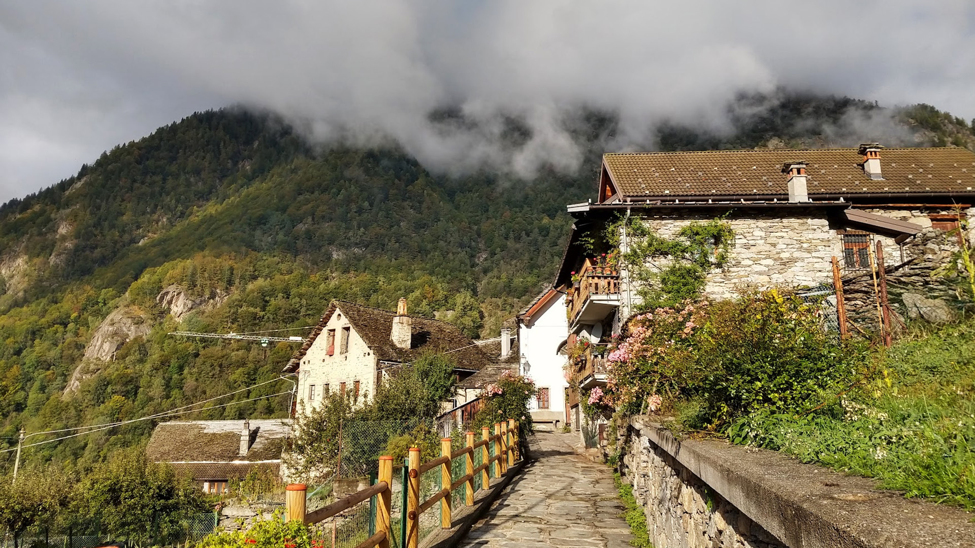
The itinerary begins from Mondelli, a small hamlet of Ceppo Morelli. In its square the “casa degli specchi” (house of mirrors) stands. Inspired by the French style of Versaille, its dinner room is entirely covered by mirrors.
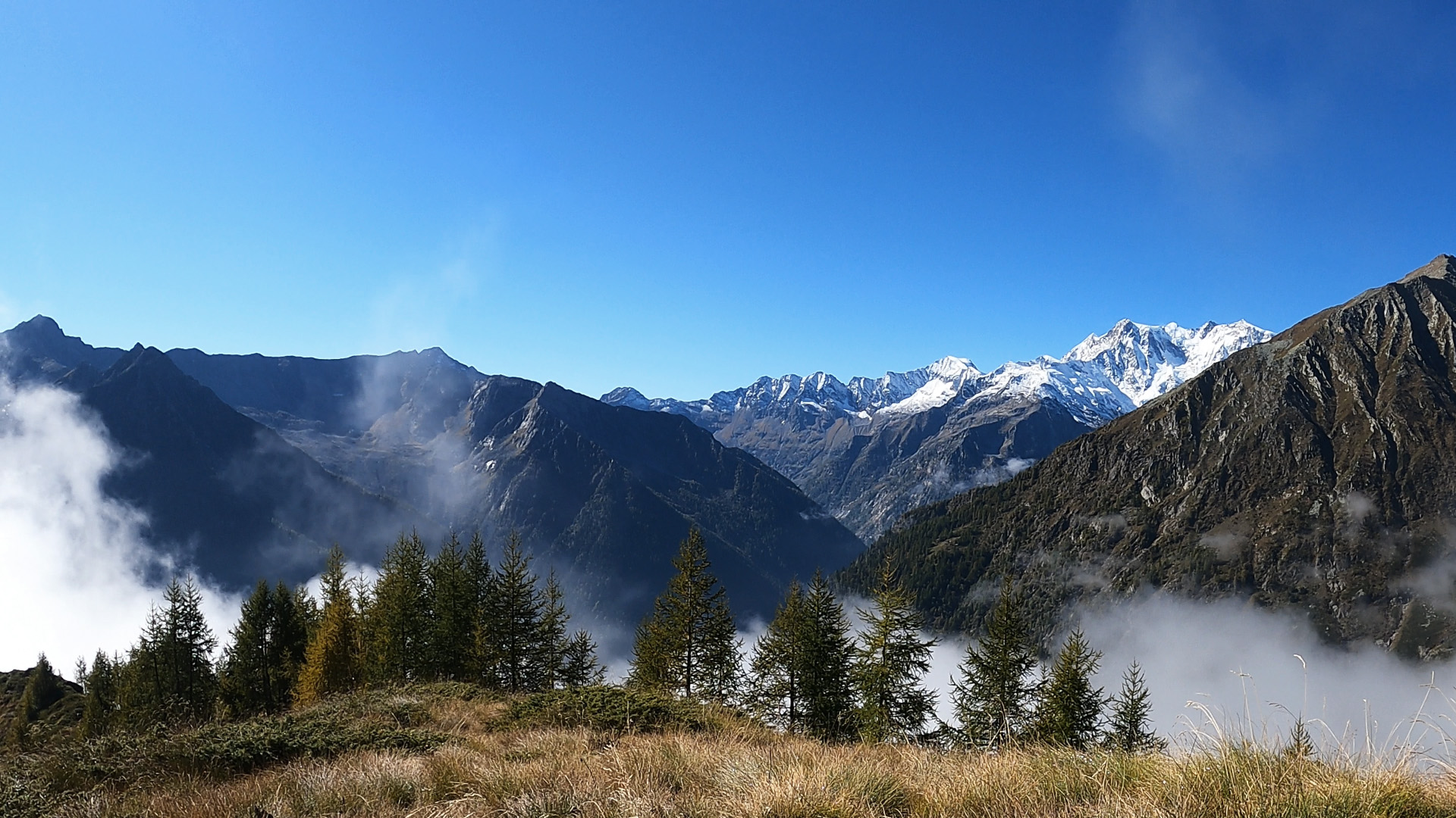
The trail immediately enters the woods, with beeches, chestnuts and birches, and goes up constantly gifting wide sights on the Monte Rosa massif. When the skies are clear, the Regina Margherita mountain hut can be seen next to Punta Gnifetti.
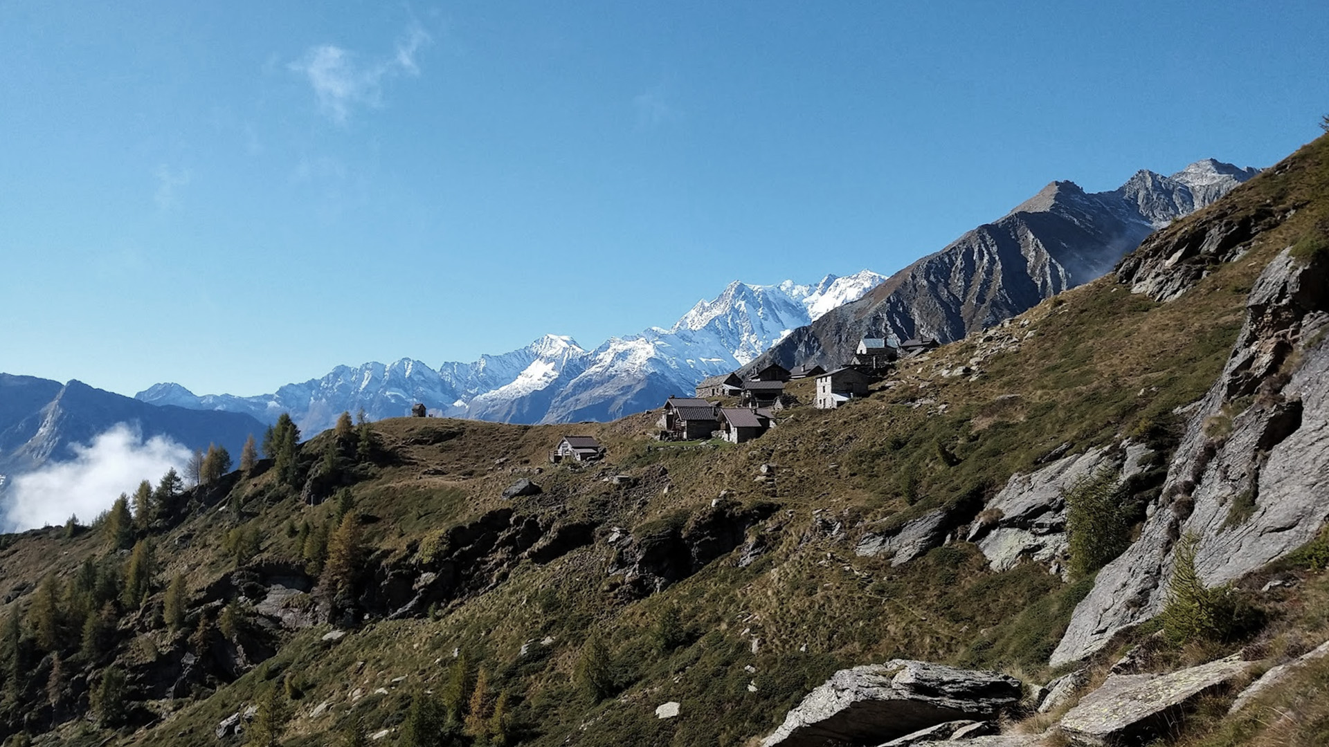
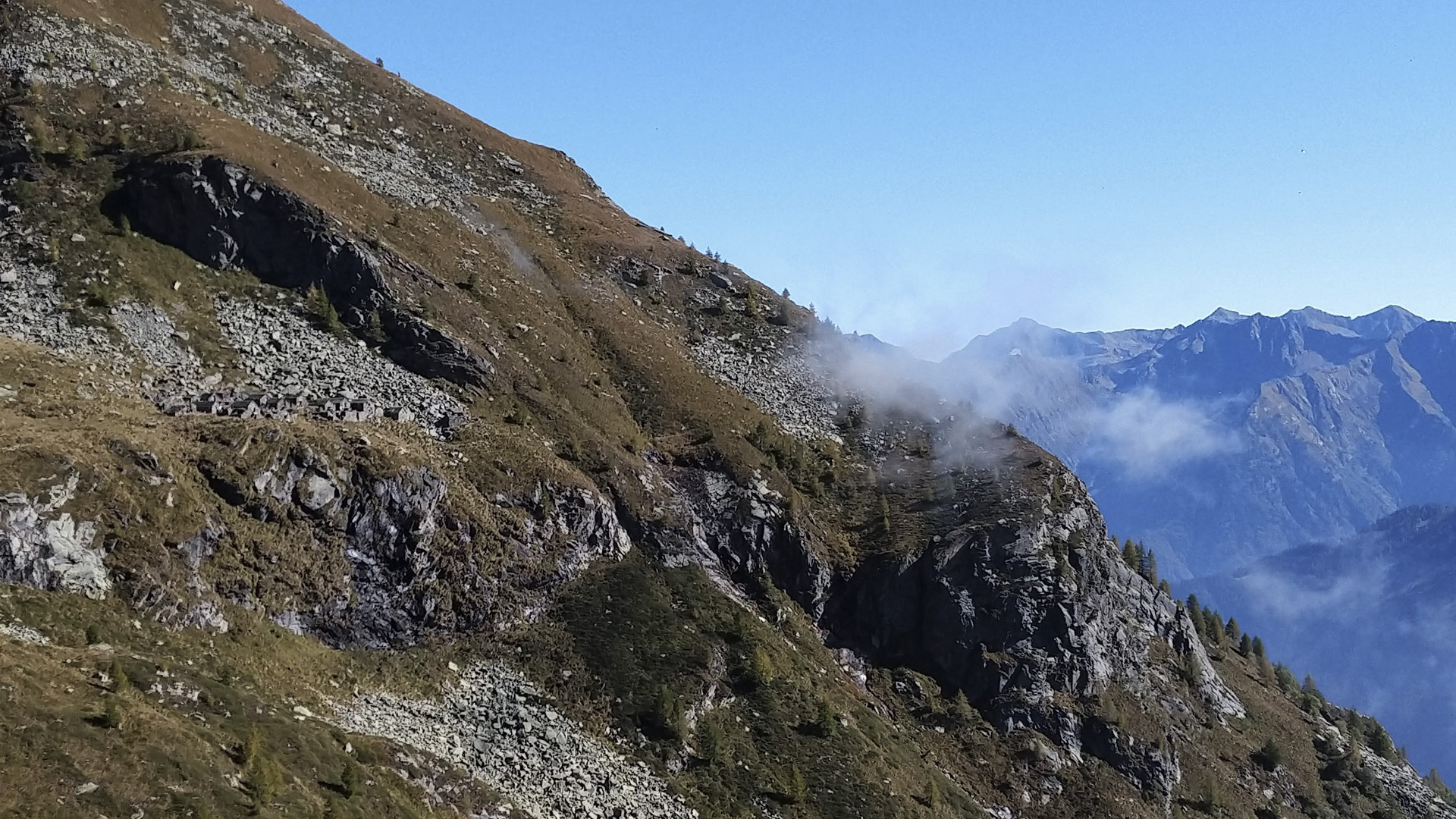
The itinerary proceeds going up the slope of mount Marigal until the ancient pasture Colla and then along the trail that winds up halfway, among junipers and rhododendrons, eventually reaching Cortenero alp: the second highest pasture of Ossola, at 2036 mt. This ancient pasture is almost concealed from sight. In fact its name comes from the dark color of the local stone, the same stone used to build the lodges that are mimetized with the background.
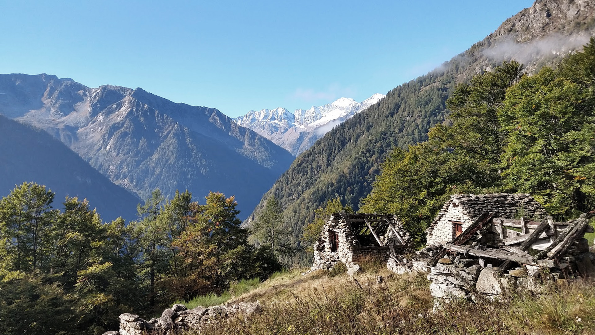
During the first years of Second World War the pasture was abandoned and later, thanks to Ceppo Morelli municipality, 11 lodges out of the 32 buildings were restored, allowing a conservation of the ancient and spectacular architecture with the barrel vault roofs, made only with stone and without any wooden beam.
One of these lodges has been donated, in 1981, by Longa family to CAI Macugnaga, who made a small bivouac out of it, dedicated to the memory of Bartolomeo Longa.
In the center of the village there are two “cup-and-ring” rocks, with later engravings of latin crosses, showing that the village was probably populated in ancient times and most likely it was active in 600 A.D.