From your phone's store, download an App to view the GPX tracks.
Some Apps, like Komoot and Wikiloc have a navigation function (upon payment).


 Click here to watch the video!


 https://www.itinerarium.it/hikes/198


 Length:
 Our time:
 Total climb:
 Min and max height:
 Type of track:
 Surface:
 Panorama:
 Cell network coverage:
 Traced in winter:
 Traced by bike:
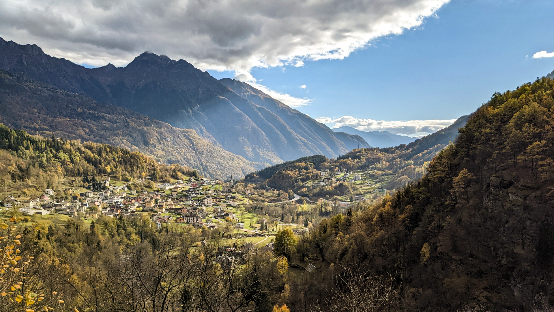
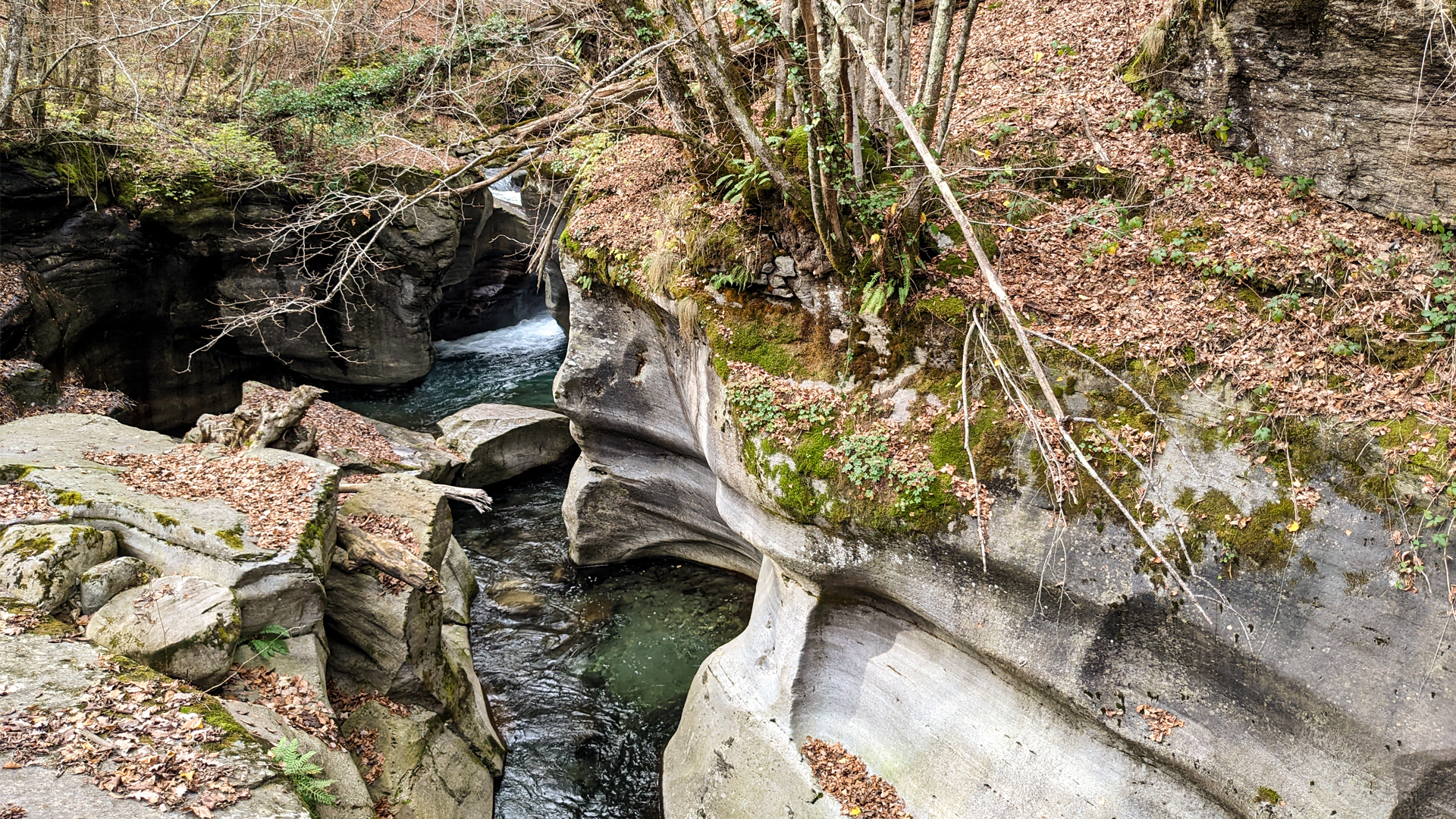
The itinerary starting from Baceno leads to Croveo and partially goes along the creek Devero, showing what the force of the water has made in the millenia: copiously flowing, whirling and twirling, the water gave birth to ravines, gorges, glacial potholes and cauldrons, in what is known as of today as the “glacial garden of Uriezzo’s ravines”.
This rich trail develops among some of the world’s unique natural elements, ancient towns, histories and legends discovering the land where the Inquisition, supported by the common superstition, gave birth to a real witch-hunt, leaving many victims along its path.
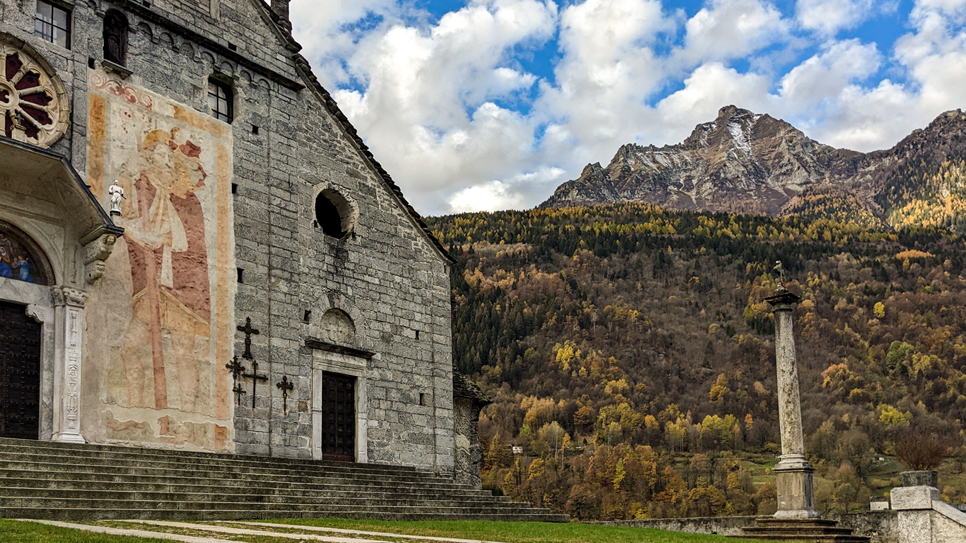
From the Roman church of San Gaudenzio in Baceno, with the large fresco of San Cristoforo on its facade, the ancient bridge Silogno is reached, abandoned following the building of the new Silogno bridge with the Strada Carrozzabile (road open to vehicles) of Valle Antigorio that reached Baceno in 1847. The ancient bridge was built on the ravine of Silogno: a twirling crack in the rock, marvelously molded by the force of creek Devero.
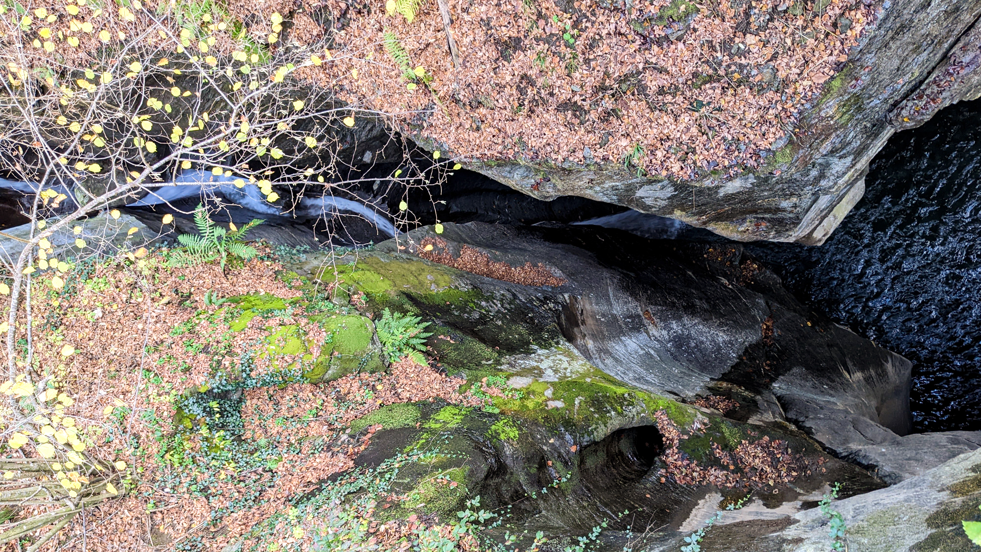
The itinerary proceeds until the giants’ kettles of Croveo, where two huge rocks support each other forming a wonderful stage for creek Devero which, in this exact point, jumps in the depths of the kettles and of the potholes in a contrast of colors made by the droplets of water that, by staying suspended in the air and hit by the sunrays, color themselves as a rainbow.
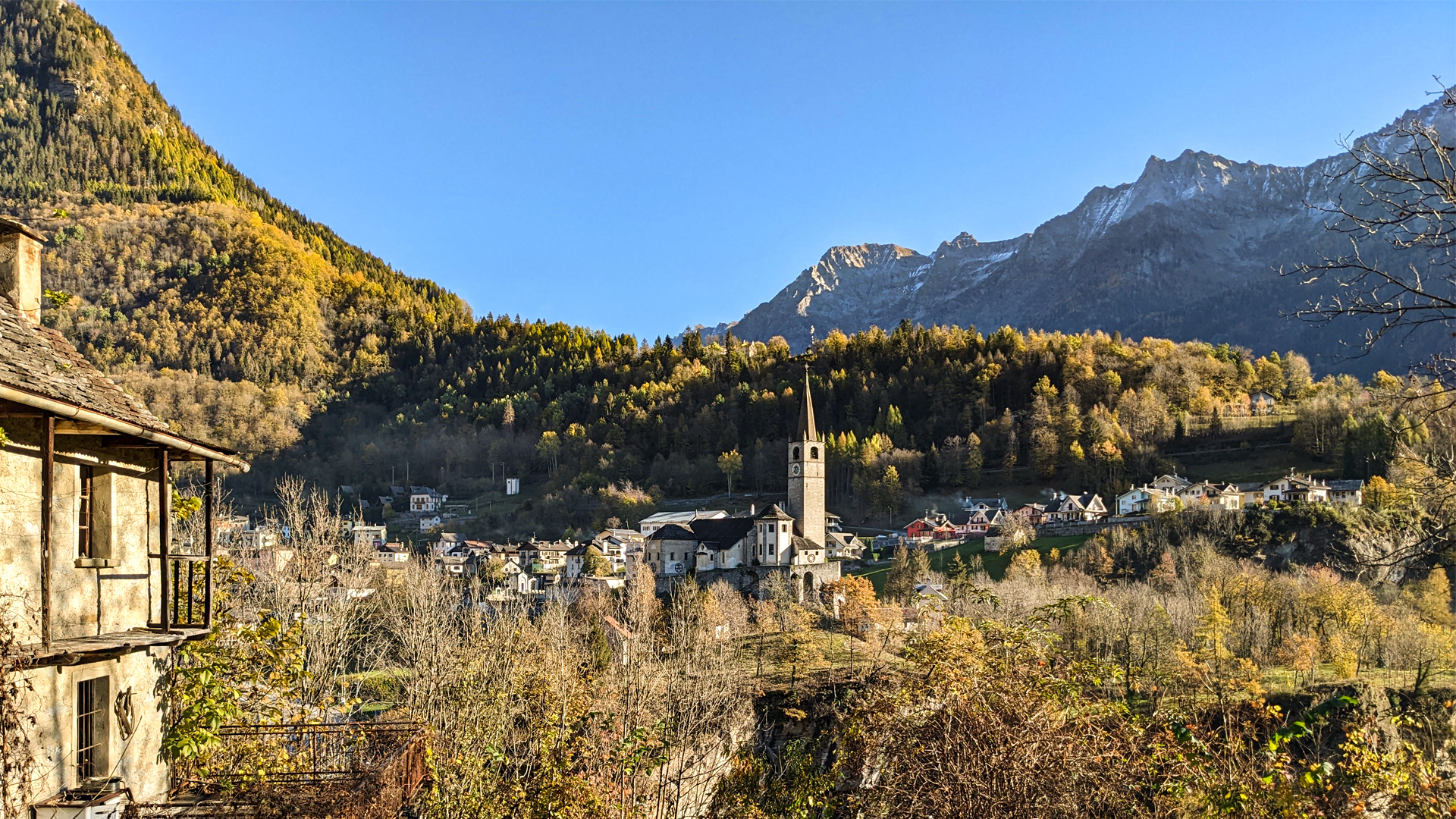
Thereafter the trail towards the town of Croveo begins, where is set the Museo del Cappellano Don Amedeo Ruscetta (chaplain Don Amedeo Ruscetta’s museum), also called “vipers' priest”: an enthusiast for reptiles and a great expert of nature, he captured the vipers to gather their venom and give it to the Serotherapy Institute of Milan. Inside the museum there is also a precious collection of ancient “cavagnette”: vertical compositions with a basket on their base where a sort of luxuriously adorned tree is placed. These structures were carried in procession by the young women of marriageable age, to show their strength.
The itinerary reaches the ancient town of Cuggine, currently abandoned, which is the typical “settlement of pass”: built along the Albrunpass road, it was an important leg serving the caravan of merchants that travelled from Milan to Bern across the Bocchetta d’Arbola. After the building of the new Simplon road, built by baron Stockalper in the ‘600, the small town of Cuggine lost importance and was slowly abandoned.